|
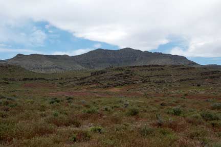
Conger Mountain

Getting There:
There are many ways to get to Delta from Salt Lake City. You can
drive south on I-15 to Santaquin, then take Highway 6 west through
the town of Eureka on to Delta or take Redwood Road all the way to
Highway 6 going on the west side of Utah Lake. You can also go on
I-15 south to Nephi, then west on Highway 132, then south on Highway
6 to Delta. When you arrive at Delta, turn right onto Highway 50
and go west through town. Continue west on highway 50 for about 63
miles just west of the summit of Kings Canyon or 72 miles to the
turnoff to the trailhead at Little Valley Well. It is about 205
miles from Salt Lake City.
Watering Holes:
In Delta there are groceries store, gas, food, RV Park, Hotel and
ATV Dealers. In Lynndly there is a gas station with many flavors of
ice cream. There is also water, food , lodging and gas at the
Boarder Inn at the Utah/Nevada Stateline.
Camping:
There are many primitive camping spots along the road up to the
trailhead and beyond.
Facilities
None.
Riding Description
We go here after going to Lyman
Caves and the family didn’t want to go riding so will describe next
time. There are about 127 miles of trails.
Elevation 5,200 to 6,800
feet.
Extra Information:
Leave all gate the way
you found them.
Signing
Most trails were signed.
Winter Riding
This could be a fun area in the winter to ride
Additional Information
Millard County (435) 864-4316
Millard County Travel
Emergencies
The closest medical Clinic is Central Valley
Medical Clinic in Nephi.
18 West 1500 N (435)623-3000
Millard County Sheriff (435) 864-2755 or (435)
743-6223
Highway Patrol (435) 743-6653
BLM Office in Fillmore (435)743-3123
Season
Best in spring and fall.
Rating
Mostly Beginner a few more difficult trails..
Conger Map
|