|
Kane Creek Canyon ATV Trail
This is one of my
favorite trails. This is a very difficult trail and will
require some road building and hand holding your ATV down by others.
You will have to have a 4X4 ATV. It offers some beautiful
views of Kane Creek canyon. It will take a good 8 hours round
trip.
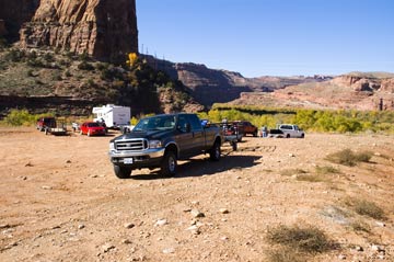 This trail starts at the parking lot on Kane Creek Road
about 5 miles west of town.
On main street in Moab you will turn west at the McDonalds
on Kane Creek road.
Continue west until there is a Y intersection. Stay left and
continue up pass the Moab Rim trail. There is a large trailhead parking lot
after the cattle guard on the right where the road turns from blacktop to dirt. There is also
several parking area's up the dirt road. There are a few posted BLM
fee camping area's up Kane Creek Canyon. There is one camp
ground before the dirt road and many on the dirt road. If you are pulling a
trailer beware that there is a steep/sharp S-Curve down the dirt
road before the camping places. Also there is the river you
will have to go through at least once. When I was there, there had been
some good rain storms and some of the camping spots were washed out. This trail starts at the parking lot on Kane Creek Road
about 5 miles west of town.
On main street in Moab you will turn west at the McDonalds
on Kane Creek road.
Continue west until there is a Y intersection. Stay left and
continue up pass the Moab Rim trail. There is a large trailhead parking lot
after the cattle guard on the right where the road turns from blacktop to dirt. There is also
several parking area's up the dirt road. There are a few posted BLM
fee camping area's up Kane Creek Canyon. There is one camp
ground before the dirt road and many on the dirt road. If you are pulling a
trailer beware that there is a steep/sharp S-Curve down the dirt
road before the camping places. Also there is the river you
will have to go through at least once. When I was there, there had been
some good rain storms and some of the camping spots were washed out.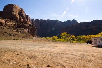
The road to Kane Creek Canyon turnoff is mostly
graded. From the parking lot you will follow Kane Creek Road
going through the river two times. There will be a fork in the
road where there is a metal sign left up Kane Creek canyon and
straight - right up to Hurrah Pass, Chicken Corners.
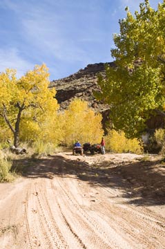 Go Left if you dare
up Kane Creek. You will cross the river
at least 25 times. I didn't count them. We were there at
the end of October and there was a few crossings that were a few
feet deep. I have heard that at times the water can be up to
your seat or higher. When going through the river bottoms section be
careful that the road ahead hasn't been washed out and it is a 3
foot drop to the river. There was a few places we lost the
trail in the river and had to find it. There are some markers
in the river bottoms to help you stay on the trail. Go Left if you dare
up Kane Creek. You will cross the river
at least 25 times. I didn't count them. We were there at
the end of October and there was a few crossings that were a few
feet deep. I have heard that at times the water can be up to
your seat or higher. When going through the river bottoms section be
careful that the road ahead hasn't been washed out and it is a 3
foot drop to the river. There was a few places we lost the
trail in the river and had to find it. There are some markers
in the river bottoms to help you stay on the trail.
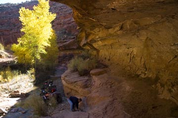
When you climb out of the river bottom the trail
splits. ATV trail
splits left from the jeep trail that goes streight up the road.
At the split there is a level area that you can park. The ATV trail goes down to
the river where there was 2 drop offs of 3 or 4 feet that required
us to build the road up. This is where our guide book stopped.
You should walk down to the river and make sure you want to do it
and that you can. You can't turn around when your down the
trail where it gets bad. Most people should turn around here. 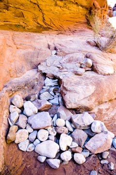
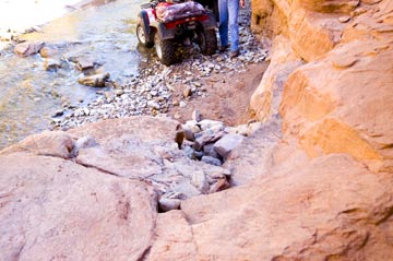
If you continue on the trail you will go through the river and up
a step bank on the other
side of the river following along a cliff to a bridge. After
the bridge on your left is some great waterfalls. You then meet back up with the
jeep trail.
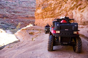 This is where there is a bunch of steep ledges that
look like stairs with black rubber all over them. Of course
the stairs are not evenly spaced. With some
hand holding on the front of the ATV and the front wheels locked in
you should make it up in low gear. This is the last difficult
spot except for a few steep river crossings. You end up on
Highway 191. This is where there is a bunch of steep ledges that
look like stairs with black rubber all over them. Of course
the stairs are not evenly spaced. With some
hand holding on the front of the ATV and the front wheels locked in
you should make it up in low gear. This is the last difficult
spot except for a few steep river crossings. You end up on
Highway 191.
We were going to turn around where the guide book
said to but didn't and ended up on 191. We road on the
edge of the road to the hole in the rock rest stop and then walked
back to camp to get the
extra truck from camp a half mile away. You could park a
vehicle at the end of Kane Creek Road off Highway 191, which is
about 200 yards south of the hole in the rock and
shuttle back. Else turn around. |