|
|
|
|
Your Add Could be Displayed HERE Contact
the Webmaster
|
|
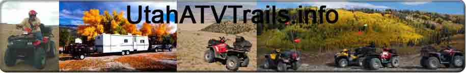
Paiute ATV Trail
The Paiute ATV Trail is the best ATV trail
anywhere period. It is what you get when you take a great ATV trail
system and super size by 10 times. The main loop Trail 01 is over
260 miles long itself and when you add in side trails you are close
to 2,000
miles of trails. The Paiute ATV Trail also connects to the Gooseberry ATV Trail to the
north, Great Western Trail to the east and the Fremont ATV Trail to the south.
The Paiute ATV Trail goes around or through 15 towns so getting gas and lodging is
not many miles away at any one time. The trail has an elevation
swing from 5,100 feet to 11,000 feet. If you are planning
to come to the Paiute ATV trail for a weekend you will only scratch
the surface. The biggest mistake people make is trying to do
to much and so
fast that you don't remember what you saw.
I have been to three Rocky Mountain ATV Jamborees, many long weekends and
a few week trips and I still have trails that I haven't been on yet.
This is a description of the trails that I have rode. I have
tried to make this information as accurate as possible. Please
review our visitors agreement and as always contact the local land
managers for up to date information. You will want a Trails Illustrated Paiute ATV Trail Map that has the trail numbers, roads to drive in for each town and distances of trails. I drive a Sportsman 500
and my 2 girls 18 and 14 drive TrailBoss's. I base my
descriptions on what I have rode with and without my kids.
My favorite Family Rides
|
My Favorite Family Rides |
My Favorite Hard Guy Rides 4X4 Good Idea |
| 1. From Richfield 04 east to Annabella up 68
to Big Lake down 01 to Koosharem. Turn north in
Koosharem to a good cafe. Return back same way.
2. From
Richfield 04 west to 01. 01 north to 00. 00
South to Devils Armchair. Bring Sack Lunch.
Return Same way.
3. From Marysvale 77 West to Bullion Canyon. An old
mine town has been restored and you can take a tour.
Bring a Sack Lunch. Then head to Hennessey Point up to
10,500 feet and then down Cottonwood Creek to trail 35 then north to trail 02
back to Marysvale.
4. From Richfield up 04 to 01. North 01 to 03 Sand
Rock Ridge. This is the 03 that is south. Down
03 to Fillmore. Eat lunch in Fillmore. Up North
03 to 01. South on 01 to 04 then return to Richfield.
(If in Fillmore go to Richfield for lunch) |
1. From Richfield up 04 then south on 01. Down 06
to 15. South on 15 to Fremont Indian State Park.
Take the frontage road highway 4 to trail 76. Go up 76
to 01. Continue up 01 the Joe Lott trail to 13.
Down 13 to the Fremont Indian State park and then up 01
north to 10. On 10 to 11. Down 11 to Elsinore.
North on 70 to 04. North on 04 to Richfield.
Bring extra gas and leave early or you may need a flashlight
on the way home.
2. From Koosharem up 01 to 33.
South on 33 to 53. Up 53 to 01. North on 01 to
89. North on 89 to 01. 01 back to Koosharem.
|
|
|
Tell us your favorite place to go riding (Your Favorite
Trail not listed suggest a destination)
|

|
|
|
|
UtahATVTrails.info is hosted by HostGator
©Copyright 2020 Askew Specialty Group L.L.C.
All rights reserved |